


Disasters have a way of freezing places in time. On April 26, 1986, reactor 4 at the Chernobyl Nuclear Power Plant exploded. Within days the town of Pripyat was evacuated. The employees of the power plant and their families never returned. Chernobyl itself, a town nine miles south of the reactor, is likewise a place out of time: nearly empty and very much undone. Its concrete bones remind us what it used to be. Its dusty classrooms and rusted apartment buildings remind us why it can never be what it once was.
But what was it, really? Chernobyl existed long before the explosion—long before scientists and planners designed the power plant and town of Pripyat, before revolutionaries built the Soviet Union, before tsars ruled the empire. Chernobyl (the place, not the disaster) is older than all of that.

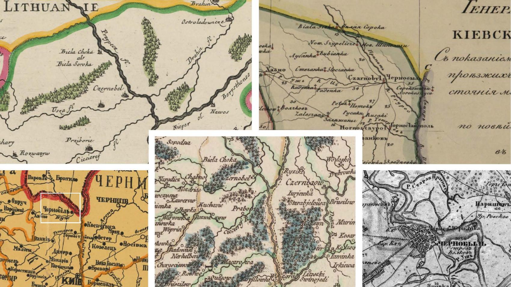
Detail from Robert de Vaugondy, Le Royaume de Pologne (1767). The red rectangle marks the location of Chernobyl/Chornobyl, here spelled Czernobel.
This digital map is available via the Harvard Map Collection. It is one of the stellar maps included in the Krawciw collection. Access a high-resolution dynamic viewing experience via this link: https://iiif.lib.harvard.edu/manifests/view/ids:8834497.
When did it become a place? When did the land, together with what grows on it and what was built on it, take on enough meaning—enough consistency and predictability—to be known and referenced and remembered? How far back must we go in order to understand Chernobyl? One year? Five? Five hundred?
The maps in this “map story” remind us that the reactor and the town are not one and the same, and that the reactor, the town, and the people who lived in it shared different fates. The maps speak of a place that was fortified and full of life. It was Jewish, Ukrainian, Polish. It was hemmed into imperial space by rivers and roads. It was a town of fishermen, boatmen, and gardeners. It sat on the edge of many grand designs, and at the center of many others.

The map: Military-topographical map of Chernobyl (1866) with annotations showing vegetable gardens and surrounding scrub forest.
The maps ask us to look back through time. But one wonders whether there are consequences to redefining the timescale of this particular place. If we go back to the 12th century, back to the days of khans and grand princes, or to the ages of hetmen and kings and tsars, will what was lost in April 1986 come into sharper focus? Or does insisting on Chernobyl as a site with deep history minimize—intentionally or unintentionally—the disaster of the recent past?
The maps begin the work of identifying the people we might write into the record. They suggest the movements of men and women born centuries ago. Might their experiences draw our attention away from the suffering and heroism of 1986? Should weeks of acute catastrophe outweigh centuries of inexorable change? Might the voice of Chernobyl become unrecognizable? Are we capable of listening to hundreds, maybe even thousands, of stories at once?
Life fled overnight in April 1986. The promise of Soviet modernization once thrummed along this stretch of the Pripyat River, but that energy is gone. The reactors are slowly, carefully, being deactivated. The power plant is being decommissioned. Pripyat—the town built to house tens of thousands of workers—is a ghost town. Chernobyl itself is full of the deafening, enduring, silence of emptiness. Each time we see a photograph of what has been left behind, we feel that emptiness. It is what defines Chernobyl in our minds and allows us an almost visceral experience of the place.

(Photograph of the Pripyat amusement park seen through the windows of an abandoned building by K. Adams.)
This map story treads quietly on that emptiness. It offers a way of re-imagining and even interacting with that space. It is a way into Chernobyl’s past—of moving through the apartments and swimming pools that have been left behind and finding the place that has always been there.
Enter the Story

Director of Graduate Studies, REECA Program, and Director, Imperiia Project, Davis Center

A.M. in Regional Studies–REECA
