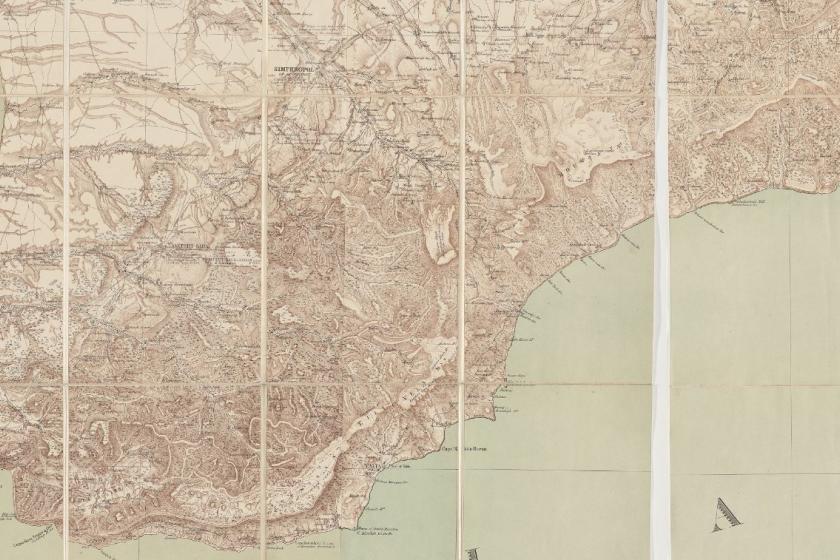
Mukhin published his map twenty-four years after the compilation of the garden registers - that is a meaningful amount of time in which all sorts of things changed. Wars, droughts, earthquakes, tragedies and triumphs of all kinds. Nevertheless, this is the first map produced at a scale that allows us a detailed look at the peninsula's topography. It allows us to see each village in its historical context. For example, here is the famous Baydar Valley.
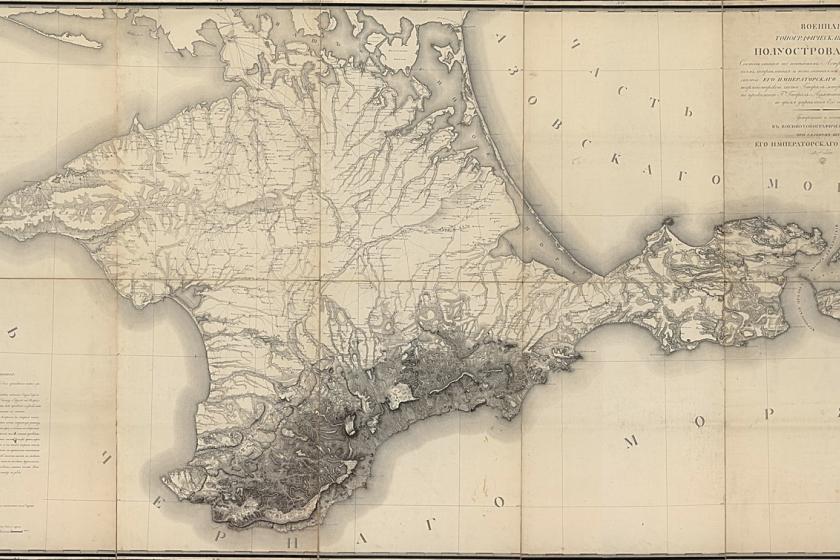
This is Thomas Best Jervis' 1855 edition of the same map. (How Mukhin's high-end military-topographical survey of Crimea ended up in British hands on the eve of the Crimean War is a story for another day.) You can see that the cartography and data are more or less unchanged. The 1855 English edition still claims, for example, that there were 80 households in the village of Baydar.